Telltale

local · sailing knowledge

Strait of Georgia sailing: crossing windows and conditions

A crossing has three parts: your shore, the open strait and the far side. Each meets a different hour of the forecast.

Before you go

  1. Read both Strait of Georgia forecasts, north and south of Nanaimo, if your route crosses the line.
  2. Estimate when you reach open water and the far side, at normal speed and 1 kn slower.
  3. Check the open-water buoys for wind and waves the morning you go. The strait
  4. Look up slack at the pass you will use. The passes

Open-water exposure

The middle of the strait has the most fetch and the biggest sea.

A calm departure tells you little about mid-strait. Check wave height and period as well as wind.
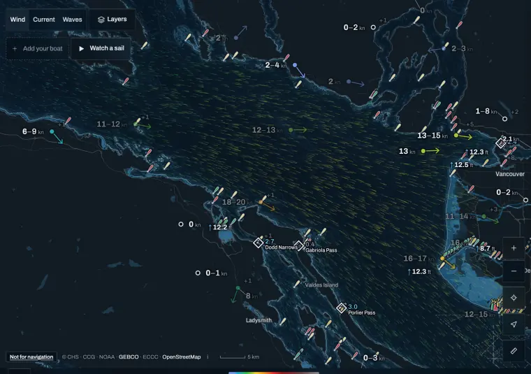
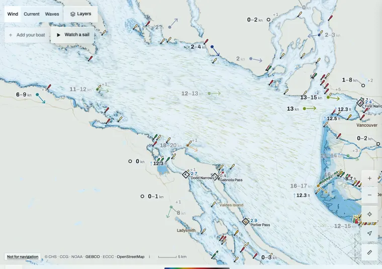
Telltale Conditions over the Strait of Georgia with modelled wind, station readings and the Gulf Island passes marked.
The Strait of Georgia in Telltale Conditions. Not for navigation.

References 1 2

Follow the crossing through time

Slower progress puts you mid-strait later.

Work out when you will be in open water and read that hour. Where the current opposes the wind, check that part of the route on its own: the same breeze builds a steeper sea against the tide.

Weather routing

References 3

Forecast areas

ECCC splits the strait at Nanaimo.

A longer passage may need both forecasts, plus Howe Sound or Haro Strait at either end.

References 2

Stations for a crossing

Pick the ones near your route.

Halibut Bank sits in the open strait west of Point Atkinson. The Southern Georgia Strait buoy is off the Fraser. Sentry Shoal is far north. Don’t average every arrow.
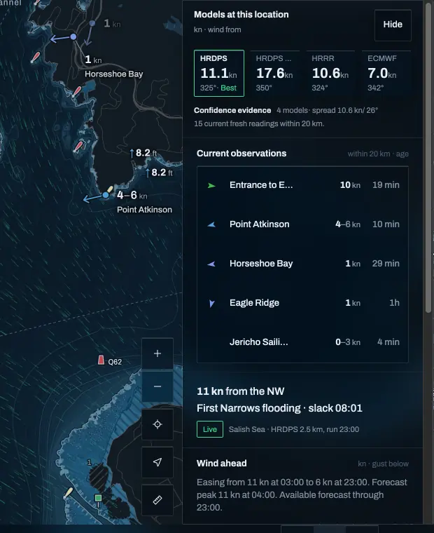
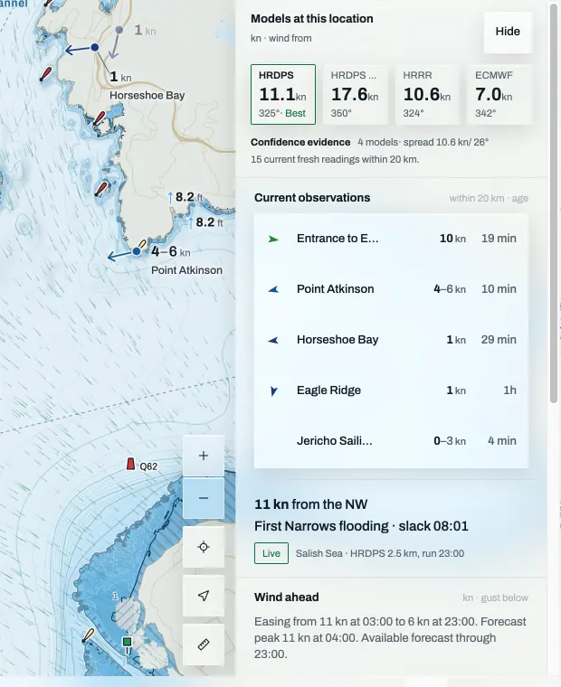
Telltale Conditions off English Bay: four model values side by side with the best one marked, the spread between them, live readings from nearby stations, and First Narrows with its next slack.
In TelltaleEvery model and the stations near one spot. Tap the water and Conditions shows each model’s wind for that spot, how far they disagree, the fresh station readings within 20 km and how the current is running. Open Conditions

References 4

The Gulf Island passes

Porlier, Gabriola, Dodd and Active Pass run hard.

Plan to arrive near slack. Telltale shows the next slack for each.
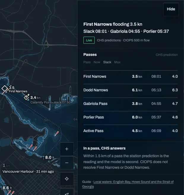
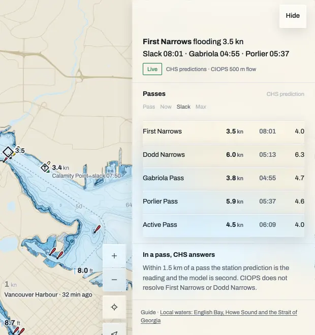
Telltale Conditions in Current mode at First Narrows: five passes with the current rate now, the next slack and the next maximum for each.
In TelltaleCurrent at the passes, with the next slack. Switch Conditions to Current for the CHS prediction at First Narrows, Dodd Narrows, Gabriola, Porlier and Active Pass: the rate now, the next slack and the next maximum. Open the passes

References 3

Sources and review

Official references checked on 2026-10-11. Product details and schedules change; the provider’s page is the current word.

Take it to the water

Check the stations before you leave, then record the sail for the debrief.

Open ConditionsRecord a sail

Latest available observations

These public stations describe their own locations, not the whole region. Values can be delayed or missing; compare station exposure before using them.

Ballenas Island

ec · marine exposure. Observed 2026-10-12 04:00 America/Vancouver.

Wind 7.5 kn from 231° true. Height: unknown. Averaging period: 600 seconds.

Halibut Bank

buoy · marine exposure. Observed 2026-10-12 04:05 America/Vancouver.

Wind 7.8 kn from 337° true. Height: unknown. Averaging period: 600 seconds.

Sentry Shoal

buoy · marine exposure. Observed 2026-10-12 04:05 America/Vancouver.

Wind 8.0 kn from 322° true. Height: unknown. Averaging period: 600 seconds.

Nearby race catalog

Open current conditions · Browse the race archive