

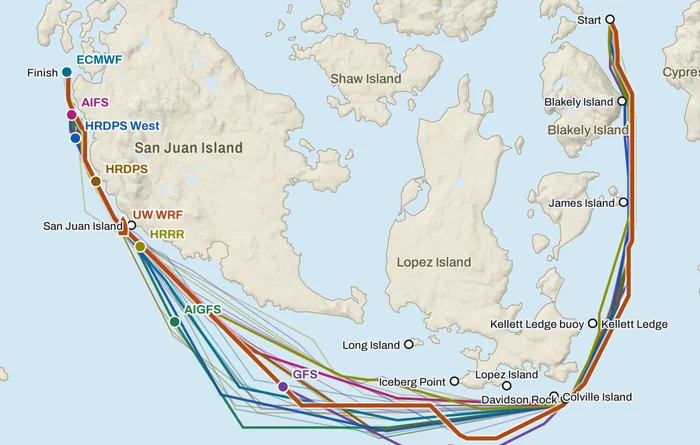

Round the County starts Saturday, first warning 08:35. Over 100 boats, two days, clockwise around San Juan County. The forecasts do not agree. So Telltale routes your boat on each of them, and checks them against the stations around the course.
Every model, on the water
Press Play. Each boat sails its own forecast against one clock: ECMWF, AIFS, GFS, AIGFS, HRRR, HRDPS, HRDPS West and UW WRF, the University of Washington's 1.33 km model.
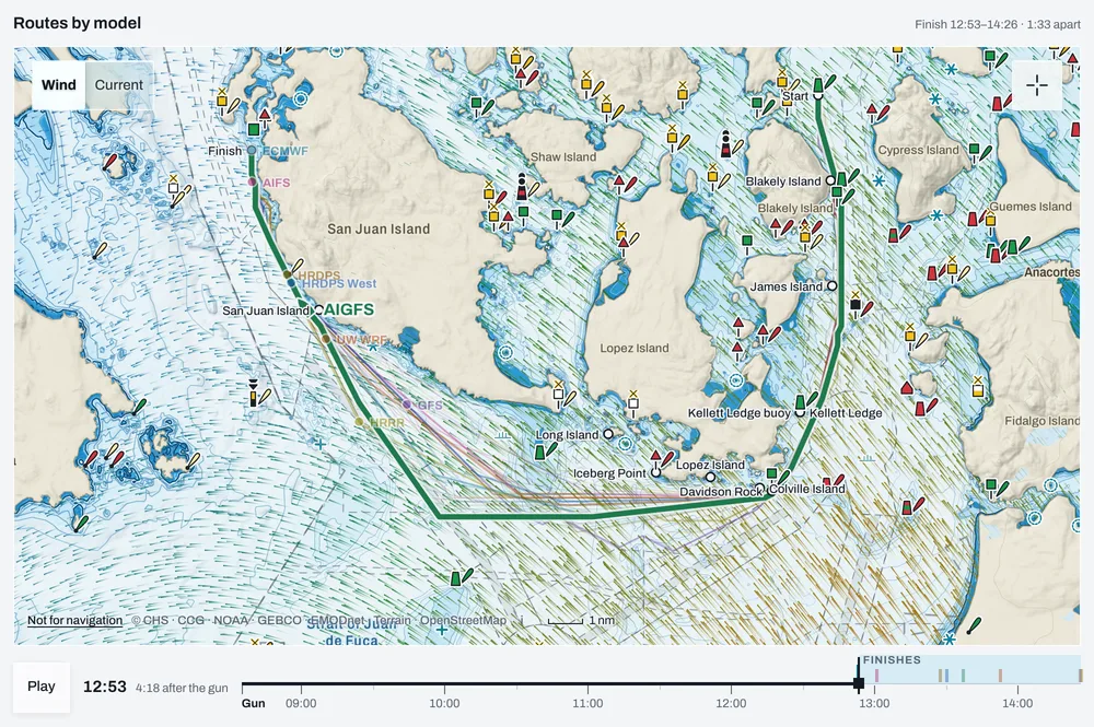
The routes leave each mark to starboard, as SI 8 says, and no route is sent to touch an island. Past Iceberg Point they spread out across the Strait of Juan de Fuca, and that is where the forecasts part.
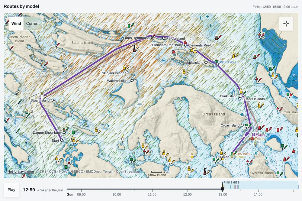
Sunday goes around the north, with the newest run of each model on one map. AIGFS finishes first at 12:58 and HRRR last at 15:05, because it barely fills in on the way back from Patos. In each row a filled dot is the latest run and hollow dots are earlier ones, so you can see a forecast getting faster or slower.
Wind, angle and current along the route
Under the map, the live view puts the whole race on one chart. The coloured line is wind speed, black is where the wind comes from, green and red are the wind angle on starboard and port tack, and the lane below is current along your course, shaded when it is with you. Drag along it and the boats on the map follow.
On UW WRF's Saturday, the ebb gives you 2.3 kn at Blakely just before 09:00 and dies past Lopez. The wind builds to about 15 kn south of Lopez by 11:30, then falls to 3–5 kn at San Juan Island and swings southwest.
At each mark, and through each gate
Next comes a row for each mark: UW WRF's rounding time, every other model's rounding as a dot either side of it, and the current and wind on the approach. The spread is 11 minutes at Blakely and 117 at San Juan Island. The models agree down Rosario Strait and part in the Strait of Juan de Fuca.
Tidal gates are NOAA current stations at the narrow spots. For each one you get the time the route passes it, the predicted current, and how much of that current runs along your heading. Saturday's route rides the ebb down Rosario Strait at 1.1 kn with you, and reaches Iceberg Point at slack.
| Gate | Passes | Current | Along the route |
|---|---|---|---|
| Peapod Rocks | 08:35 | 1.3 kn ebb | 0.5 kn with you |
| Rosario Strait | 09:50 | 1.1 kn ebb | 1.1 kn with you |
| Point Colville | 10:14 | 0.8 kn ebb | 0.8 kn with you |
| Iceberg Point | 10:56 | slack | slack or across |
| Haro Strait, Lime Kiln | 12:51 | 0.8 kn flood | 0.7 kn with you |
| Kellett Bluff | 13:33 | 0.2 kn flood | slack or across |
UW WRF 12Z Nov 6 route, Race 1. Source: NOAA CO-OPS current predictions.
Which forecast do you trust?
Do not take our word for any of them. Every model is scored against the stations around the course, and you can read any station against the forecasts yourself.
Each model is scored against the last few hours of station readings. Direction error is the typical miss in degrees, and the bias columns are the average miss with its sign, so a model that is always veered, backed, light or strong shows there. In this window HRDPS West is closest on direction, at 15° with 2° of bias, while ECMWF, GFS and AIFS are all more than 4 kn off on speed.
| Model | Run | Direction error | Direction bias | Speed bias, kn |
|---|---|---|---|---|
| HRDPS West 1 km | Nov 6 04:00 | 15° | −2° | −2.0 |
| NOAA AIGFS (AI) | Nov 6 10:00 | 20° | +0° | −0.9 |
| HRRR 3 km | Nov 6 16:00 | 27° | −15° | −3.4 |
| ECMWF IFS | Nov 6 04:00 | 27° | −19° | −5.2 |
| GFS | Nov 6 10:00 | 28° | +0° | −4.3 |
| ECMWF AIFS (AI) | Nov 6 10:00 | 29° | −11° | −4.1 |
| UW WRF-GFS 1.33 km | Nov 6 04:00 | 31° | −22° | −1.0 |
| HRDPS 2.5 km | Nov 6 16:00 | 33° | −31° | −3.0 |
The 3 hours to Friday evening: 23 readings at 6 stations, best direction first. A short window says little about Saturday. The live table on the race page updates as readings come in.
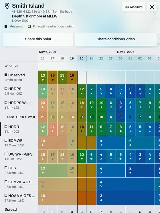
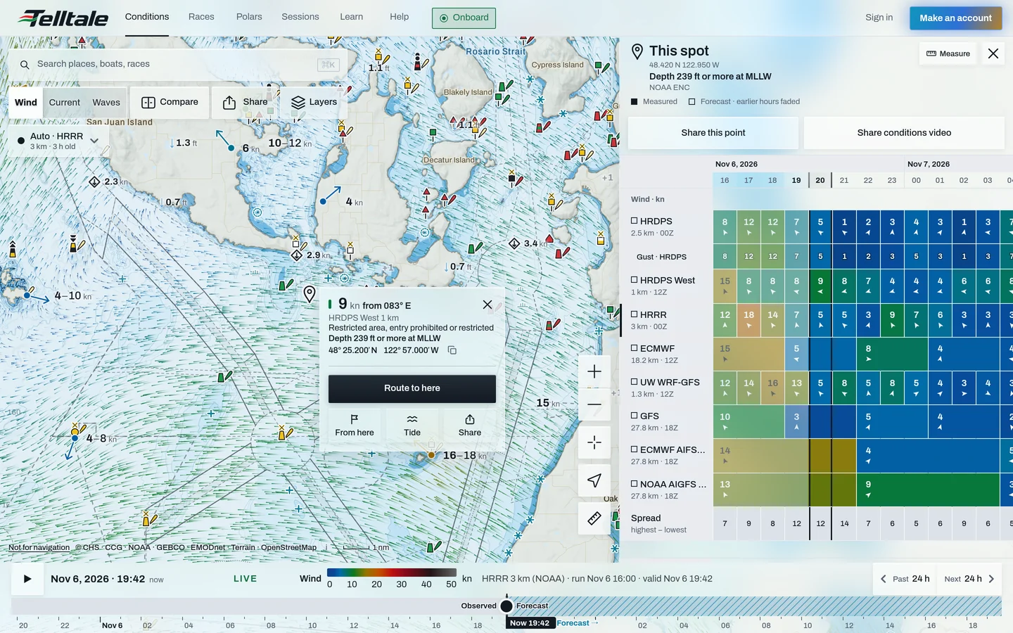
Open any station and you get its measured wind (top row) against every model, hour by hour. Colour is speed and the bottom row is the spread from highest to lowest model. Friday afternoon Smith Island read 13–16 kn while the models ranged from 10 to 21 kn, and overnight they still sit 3–7 kn apart.
Tap anywhere on the water, not only at a station, to get the same table for that spot. In the Strait south of Lopez on Friday evening, the models are 14 kn apart at 21:00.
At the nav station
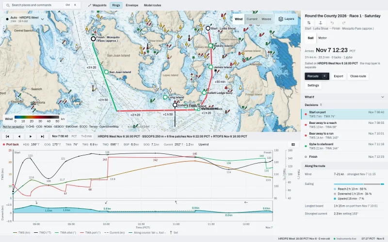
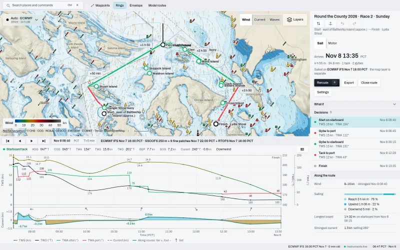
On a laptop, Telltale Desktop routes your boat around the course on its own polar: pick Round the County, pick your start, and it opens with every decision and the wind along the route on one screen.
The route is drawn by tack, red on port and green on starboard, and the right panel lists each decision with its time, wind and angle, then splits the race into reaching, running and beating. Race 1 on HRDPS West has no tacks and one gybe, and is 59% reaching. Race 2 on ECMWF has one tack and two gybes and is 76% reaching, and the brown fill under its chart is current against you past Stuart.
In your pocket
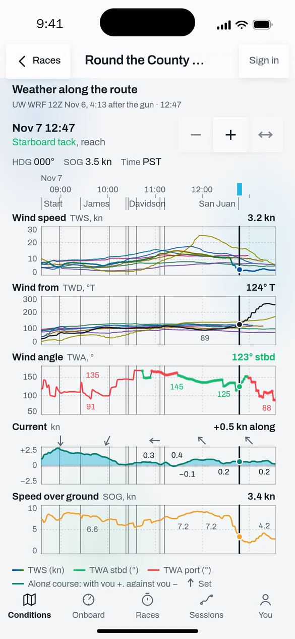
On a phone the combined chart splits into stacked lanes that share one time cursor: wind speed with every model's line, direction, wind angle, current along the course and speed over ground.
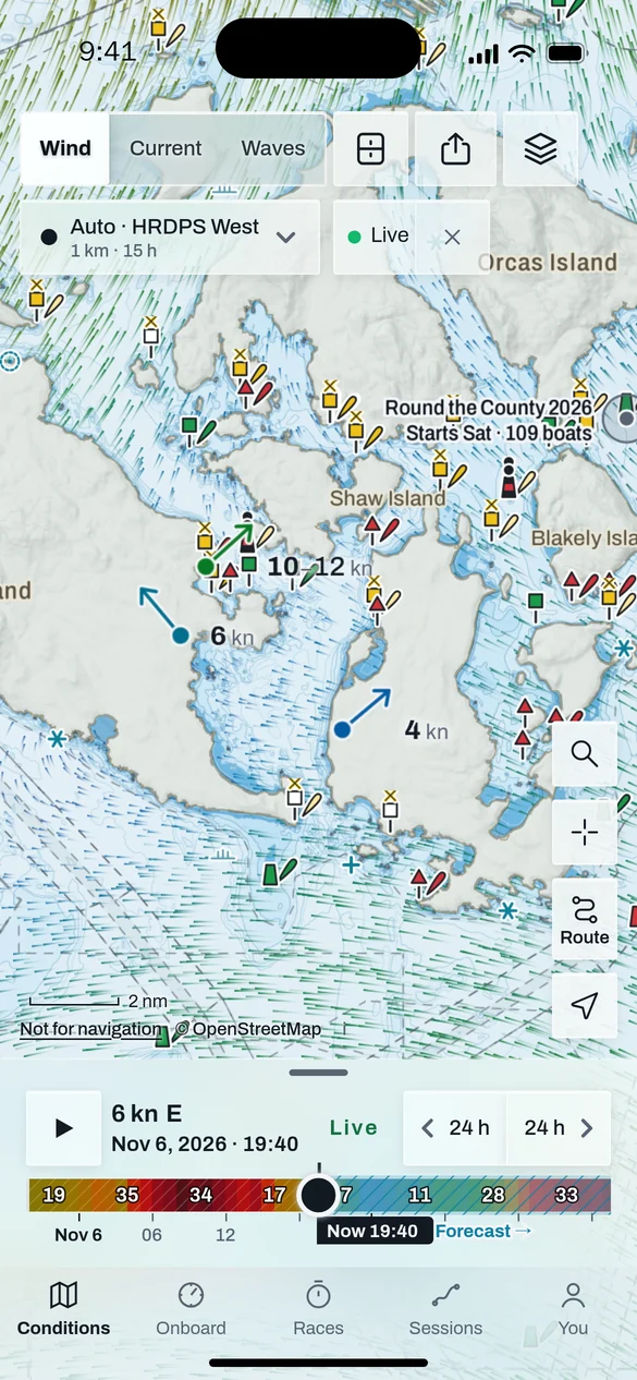
Your polar, then your race afterwards
Routes start from your class's polar, read from real certificates, and your own boat's once you add it.
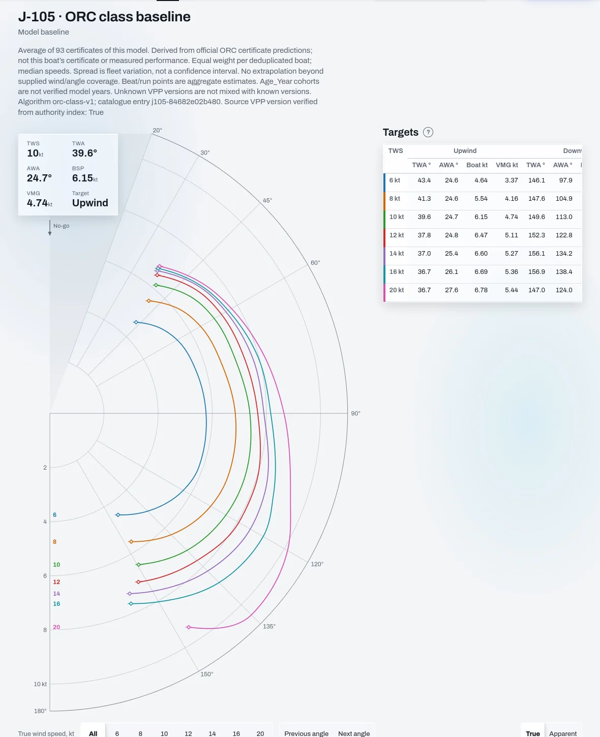
The J/105 class polar averages 93 ORC certificates. Each curve is boat speed against wind angle at one wind speed, and the table gives the targets: in 10 kn, 6.15 kn at 39.6° upwind.
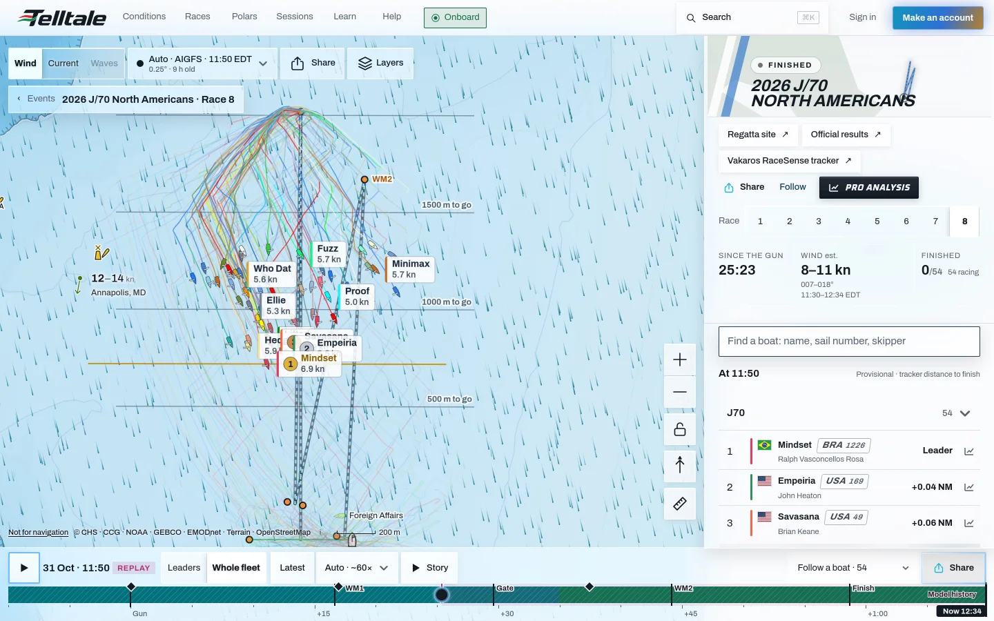
And after the finish, the race stays open: every boat on the water, replayed, with analysis of where it was won.
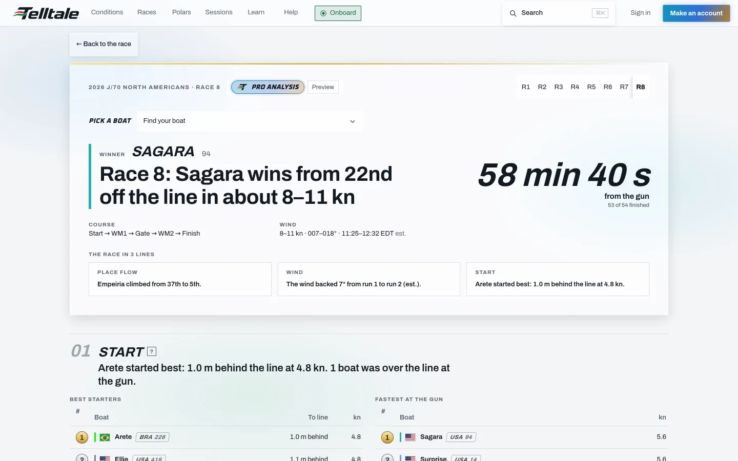
The analysis reads every track, as in our J/70 North Americans analysis. It shows who started best and who was fastest at the gun, the places gained on each leg, and how the wind shifted between laps.
Route your boat
Open the Round the County brief, tap Route my boat, and pick your entry.